Revival of an archaeological heritage structure with BIM 3D laser scanning
Heritage structures and old buildings play an important role in our society as they connect us to our past, our culture, and our journeys across time. Their glory also makes them an attractive location to house important centres of governance and other facilities of prestige, as well as tourist destinations.
Their optimum upkeep is integral to their existence but it gets compromised due to the absence of original structural drawings in most of the cases. Absence of such drawings hampers maintenance, conservation and preservation, restoration, renovation, readiness for modern dwelling, public engagement, and rebuilding damaged parts.
Use of LiDAR-based BIM 3D modeling to revive British Residency in Hyderabad
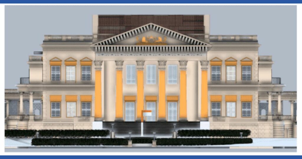
The British Residency in Hyderabad in Telangana state in India is an opulent mansion built in the early 1800s as a British ambassadorial residence. The building was also the embassy of the East India Company to the court of the Nizam of Hyderabad. The structure is now a protected monument.
Following a restoration initiative for the monument to preserve its historic architecture and cultural heritage, Marvel Geospatial was commissioned by the Heritage Department of the Government of Telangana State for a 3D replica of the structure. The creation of a 3D BIM model through LiDAR scanning was identified to meet the requirement.
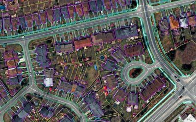
LiDAR point cloud data generation
After referring to the site images for a better understanding of the building type (whether residential or commercial), the present situation of the building (whether constructed or under construction), and the required LOD (level of detailing) for the BIM Model, the Marvel Geospatial team started off LiDAR point cloud data generation for 3D modelling of the structure.
The Marvel Geospatial team used Kaarta Stencil Pro scanner for large indoor areas and Kaarta Contour for narrow paths and small Indoor Areas. Once the area was scanned, features were identified in the scanned area. If any features were missed out, they were to be covered in the next scan.

The scanning execution stage involved coverage of all features in the AOI (area of interest), identifying any restricted areas in/near the AOI, and checking for any obstacles like light-reflected areas in the LiDAR survey.
Post-scanning checks involved overlap between the adjacent scans, finding any gaps, and scanning for accuracy and feature alignment. Post-processing involved noise cleaning, scan files registration, video and image segregation, accuracy and feature alignment.
Production of the BIM model
The production of the BIM model was based on RCP/RCS format LiDAR data, videos and images of the site, rough sketch of the site, and level of detailing (LOD) of the model. The production involved the creation of architectural elements, creation of structural elements, placing families like chairs, sofas, systems, racks etc, and providing material and textures for the elements, preparation of floor plans, sectional drawings and elevation drawings, and preparation of structural drawings.
A 3D BIM model with LOD 300 was created for the structure (British Residency) through LiDAR scanning.

Use cases of Scan-to-BIM 3D laser scanning for heritage structures:
- Maintenance
- Conservation and preservation
- Restoration
- Renovation
- Readiness for modern dwelling
- Public engagement
- Recreating the structure with 3D print from 3D model in case of damage to any part of the structure
View our video on BIM 3D laser scanning of British Residency, Hyderabad
Connect with us for your 3D laser scanning, LiDAR, Scan-to-BIM requirements. Reach out to us at info@marvelgeospatial.com