Photogrammetry Services for Mapping & Analysis
Marvel Geospatial processes aerial photos into detailed orthomosaics, elevation models and 3D visuals through advanced photogrammetry services. These outputs power corridor surveys, land analysis and planning for infrastructure and public sector needs.
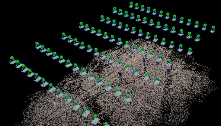
Aerial Triangulation
- Triangulating large quantity of aerial images, UAV images and satellite scenes
- Triangulation of images captured from the latest digital cameras and sensors.
- High geometric stability of the blocks with well-defined external orientation and additional parameters meeting the RMSE within tolerance.The blocks have high geometric stability with well-defined external orientation and additional parameters that meet the RMSE within tolerance.
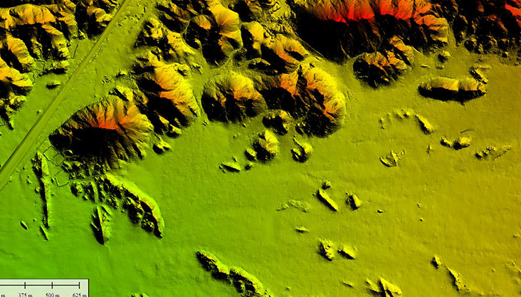
Digital Elevation model
- Advanced auto correction methods to extract highly accurate Digital elevation model (DEM)
- Deriving 3D models very quickly and affordably, providing maximum exploitation of imagery captured with digital aerial sensors as a basis for orthophotography, terrain modelling, planimetric mapping
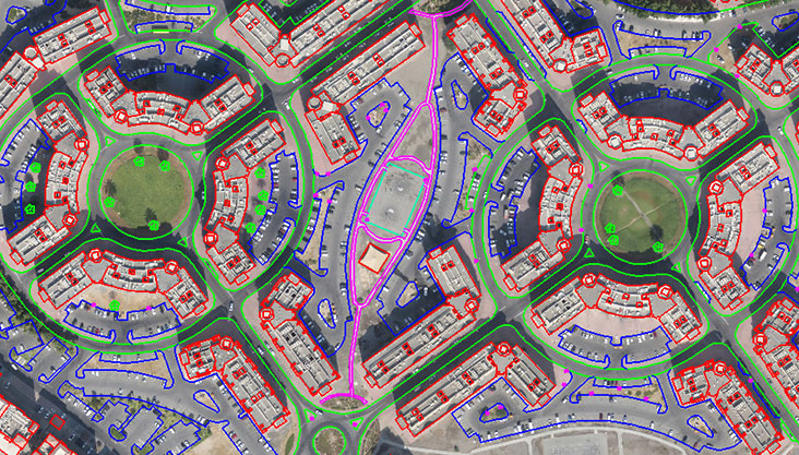
Planimetric mapping
- Planimetric data from aerial photographs and satellite stereo images
- Large scale mapping where the planimetric details are captured from high resolution aerial photographs with high accurate generating precision 1 foot contour
- Details like transportation, buildings, structures, hydrography, vegetation, boundaries, utilities etc captured for comprehensive GIS solutions or for individual projects
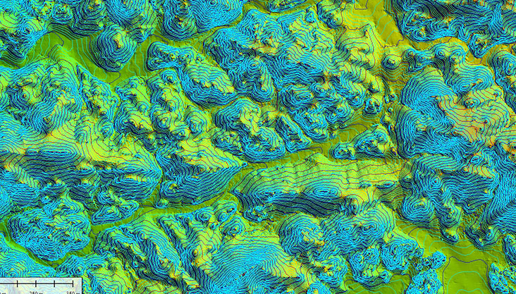
Topographic mapping
- Development of topographic data in a softcopy environment
- Edge-matching data results in a seamless project-wide topographic representation
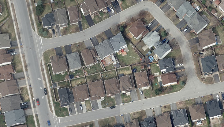
Orthophoto Production
- Creation of ortho-rectified images from aerial images.
- Processing of satellite images of different sensors
- Radiometric correction, atmospheric correction, image fusion (resolution merge), histogram matching (tonal balancing)
- Geo-referencing, ortho-rectification, ortho mosaic, color balancing
- Data cut into easily manageable size tiles for better file
- True orthophoto, ie, geometrically correct over the entire image, instead of being correct only at terrain level
Let us know your requirement.
Get in touch with us for:
- Free consultation
- Service Order
- After-sales support