Marvel Geospatial offers enterprise-grade annotation and labeling services, leveraging AI-powered workflows and expert human annotators to deliver high-quality training datasets. With extensive experience in geo-annotation, we specialize in labeling aerial, satellite, and drone imagery, ensuring precise data for machine learning and computer vision applications. Our advanced tools and industry-specific expertise help train AI models efficiently, reducing curation fallouts and enhancing data accuracy.
We customize annotation solutions to meet diverse industry requirements, from road mapping to terrain modeling. By transforming unstructured geospatial data into actionable insights, we empower businesses with accurate datasets for GIS applications, autonomous navigation, and spatial analytics. Our streamlined processes ensure timely, cost-effective AI model training, helping organizations optimize their geospatial intelligence strategies
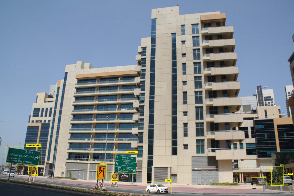
Bounding Boxes
Training AI Models for Autonomous Driving
Computer Vision for Spatial Cognition
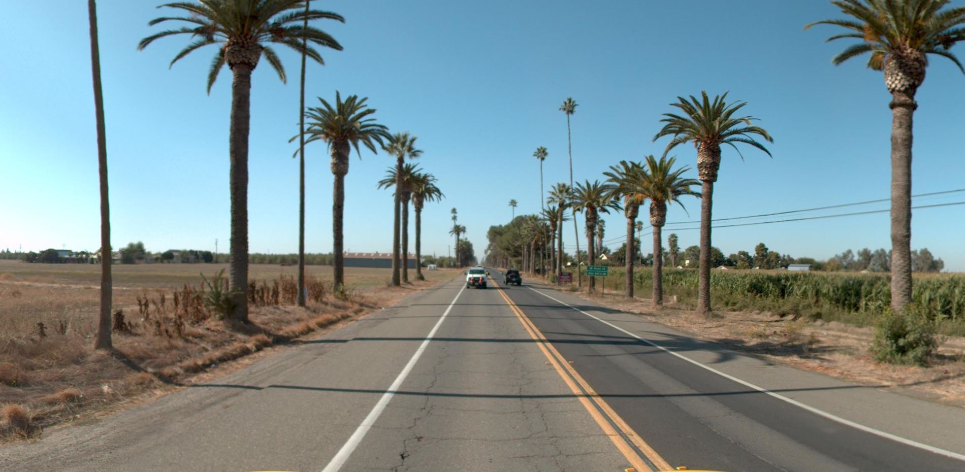
Lane Detection for Autonomous Vehicles
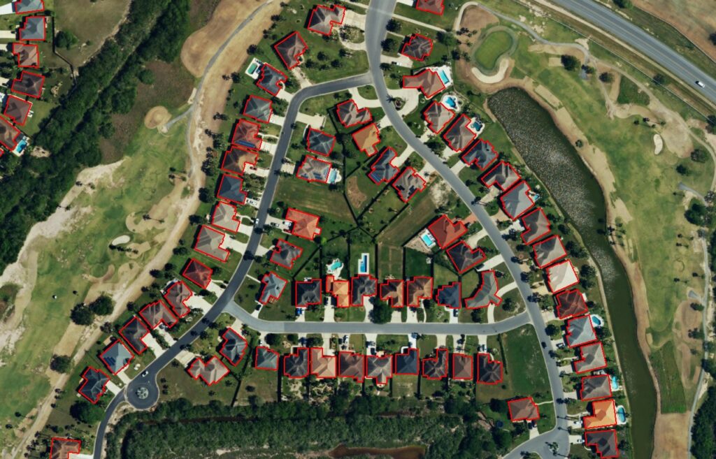
Polygons
Precise Object Shape Identification
AI & Machine Learning Training Data Creation
Industry-Specific Geospatial Data Labeling
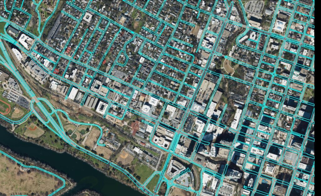
Polylines
Lane Annotation for Autonomous Vehicles
Road, Highway, and Coastal Line Mapping
Training AI Models for Boundary Recognition
Geo-Annotation
Geo-Annotation for Aerial & Drone Imagery
Training Data for Machine Learning & Computer Vision
Bounding Box & Semantic Segmentation for Spatial Analysis
Let us know your requirement.
Get in touch with us for:
- Free consultation
- Service Order
- After-sales support